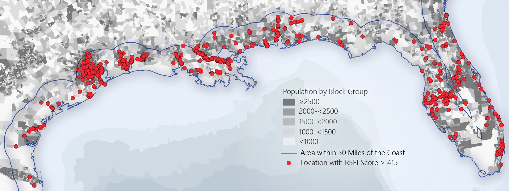
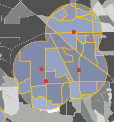
As a research assistant at George Washington University, I used ArcGIS to estimate the percentage of the population living within 1.5 miles of hazardous chemical facilities within 50 miles of the Gulf Coast. I also found the number of hospitals and schools within the same area.
The results of the analysis as well as these figures were published in the AGU journal GeoHealth:
Back to portfolio